

All the monuments, city by city
The landmarks and masterpieces worth planning a day around.
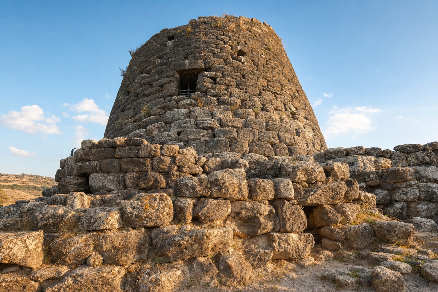 BaruminiUNESCOSu Nuraxi di BaruminiGreatest nuraghe complex, Bronze Age tower village, dry-stone corbelling, Giovanni Lilliu's excavationBronze Age Sardinians built some seven thousand nuraghi, cone-shaped stone towers, and Su Nuraxi is the grandest that survives: a central keep raised around 1500 BCE, ringed a few centuries later by four corner towers and an outer wall, with a village of round huts spreading beyond it. The whole complex lay buried under a hill until the archaeologist Giovanni Lilliu excavated it between 1949 and the mid-1950s, uncovering corbelled chambers built without mortar that still hold. Who built the nuraghi, and whether they were forts, granaries, or chieftains' seats, is still debated. UNESCO listed the site in 1997. Visits are guided only, in groups leaving every half hour, and involve some clambering over uneven basalt, so wear real shoes.Plan the visit
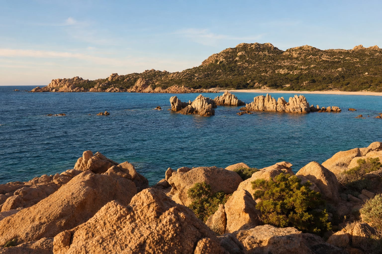 La MaddalenaLa Maddalena ArchipelagoSeven granite islands, Budelli's pink sand, Garibaldi's house on Caprera, clear Mediterranean watersSeven granite islands and dozens of smaller islets and rocks make up La Maddalena's archipelago, set in some of the clearest water in the Mediterranean and protected since 1994 as a national park. Ferries from Palau reach the main town after a short crossing, but the real draw lies beyond it: Budelli's Spiaggia Rosa, its sand tinted pink by crushed coral and shell fragments, has been off limits to swimmers and anchors since 1998 and is now seen only from a boat gliding past. On Caprera, Giuseppe Garibaldi farmed and wrote through his last years; his white house, the Compendio Garibaldino, still holds his furniture and weapons, and the plain room where he died in 1882.
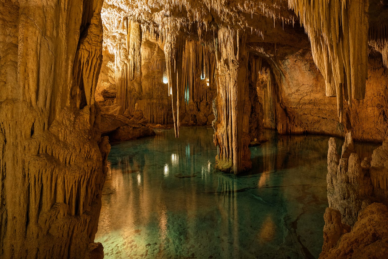 AlgheroNeptune's GrottoStalactite halls by the sea, 654-step Escala del Cabirol, salt lake, boat arrival from AlgheroNeptune's Grotto opens at the foot of the 110-meter cliffs of Capo Caccia, west of Alghero, in halls of stalactites and stalagmites around a lake of salt water. Half the event is getting there. You can descend the Escala del Cabirol, the Goat's Stairway of 654 steps cut into the rock face above the open sea, or arrive by boat from Alghero harbor and step straight onto the landing. A guided walk leads through the chambers, so leave time for the stairs or the boat on top of the visit itself.
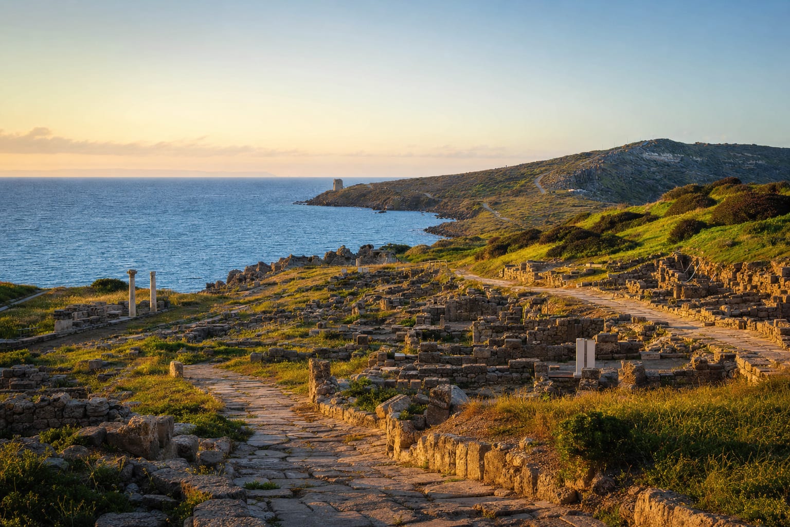 TharrosTharrosPhoenician port, basalt main street, twin Corinthian columns, tophet, San Giovanni towerTharros spreads down the tip of Sardinia's Sinis peninsula toward the bay, a Phoenician colony from the eighth century BCE built beside an older nuragic village. It flourished under Carthage, and after the Roman conquest of 238 BCE gained baths, an aqueduct and a paved street network; its basalt main street is grooved by centuries of Punic and Roman traffic. Two re-erected Corinthian columns from a temple mark the skyline between the Spanish tower of San Giovanni and the open sea, and beyond the necropolises the tophet, a Phoenician sanctuary where the ashes of children were buried, is the site's most somber corner. The city was abandoned around the year 1000. Combine it with the beach at San Giovanni di Sinis.
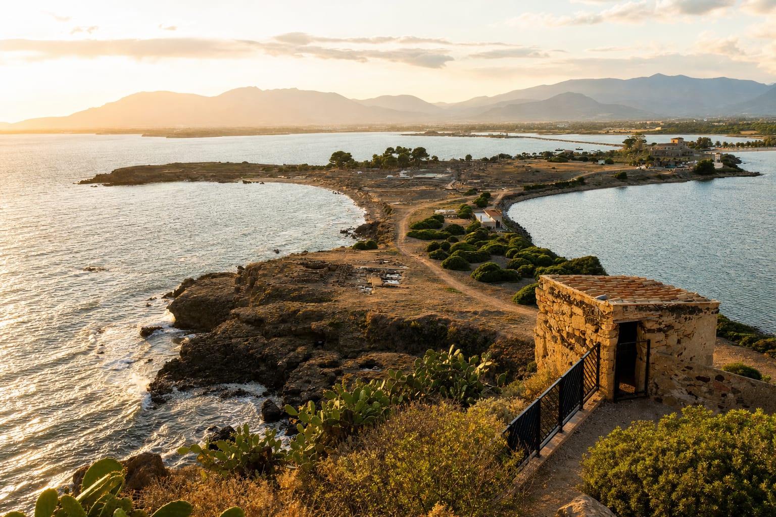 PulaNora Archaeological SitePhoenician-Roman town on a cape, seaside theatre, mosaic floors, Nora Stone findspotPhoenician traders founded Nora on a low cape south of Cagliari, and Carthaginians and then Romans built over them, so the ruins read as a layered port town with the sea on three sides. Here in 1773 came the Nora Stone, a Phoenician inscription of the late ninth or early eighth century BC that gives the earliest written form of the island’s name; it now sits in Cagliari’s national archaeological museum. On site, walk the paved Roman streets, the bath complex with its mosaic floors and the small theatre, still used for summer performances. Erosion has taken part of the ancient town into the water, and on calm days you can make out walls just under the surface.
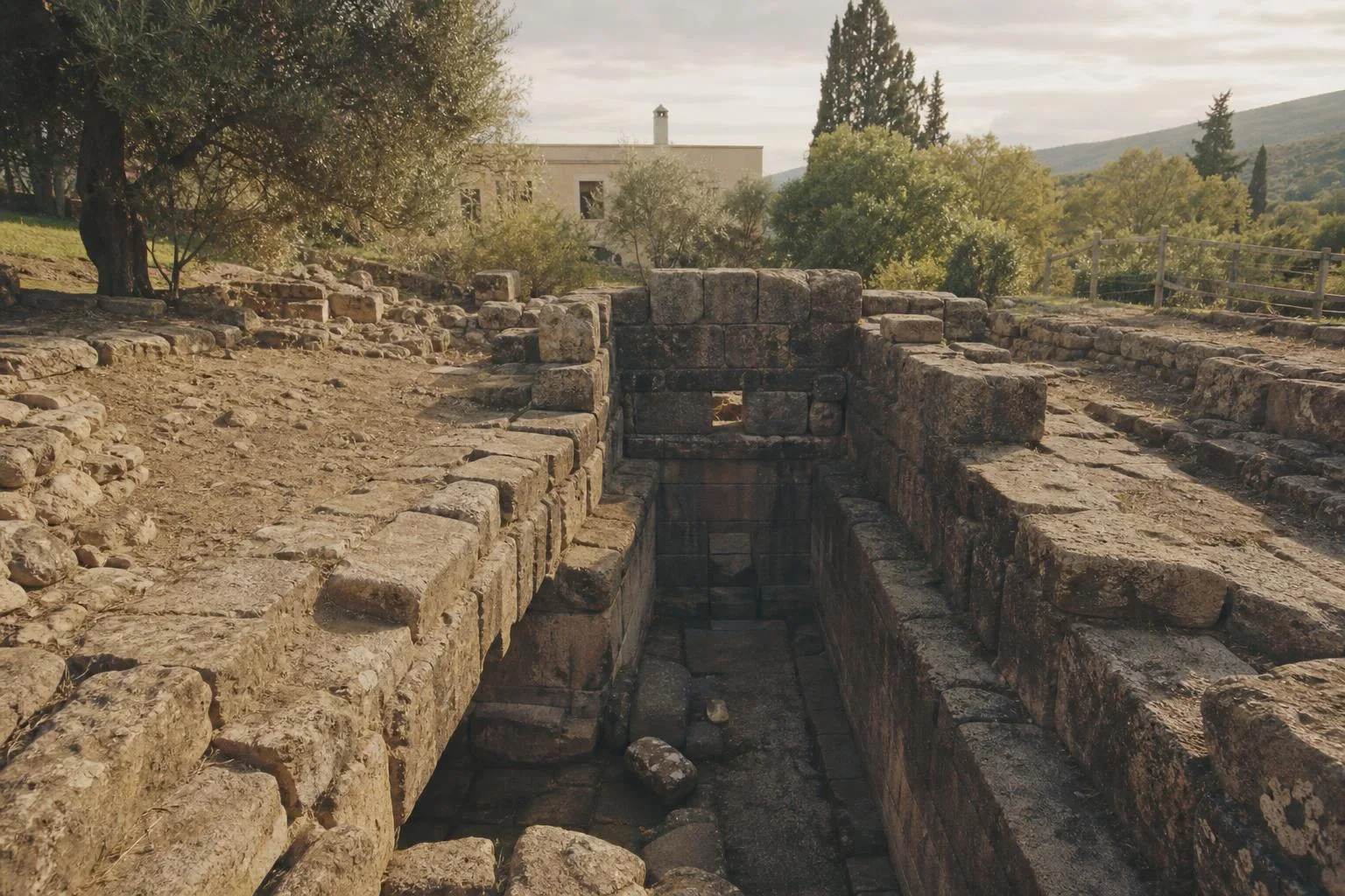 BaruminiHidden GemFuntana CobertaNuragic sacred well, twelve-step staircase, false dome, water worshipFuntana Coberta, the ‘covered fountain’, is one of the best-preserved Nuragic sacred wells in Sardinia. Built between the thirteenth and ninth centuries BC over a spring near Ballao, in the Gerrei hills, it follows the classic three-part plan of a small open vestibule, a stone staircase of twelve steps beneath a covered roof of lintels, and a round chamber with a false dome about 5.5 meters high, above a well shaft five meters deep. The Nuragic people worshipped water here, and excavations found bronze swords, oxhide-shaped ingots and bronze statuettes. Excavations started in 1918 under Antonio Taramelli and resumed in 1994 and 2008. Today a steel grille protects the well.
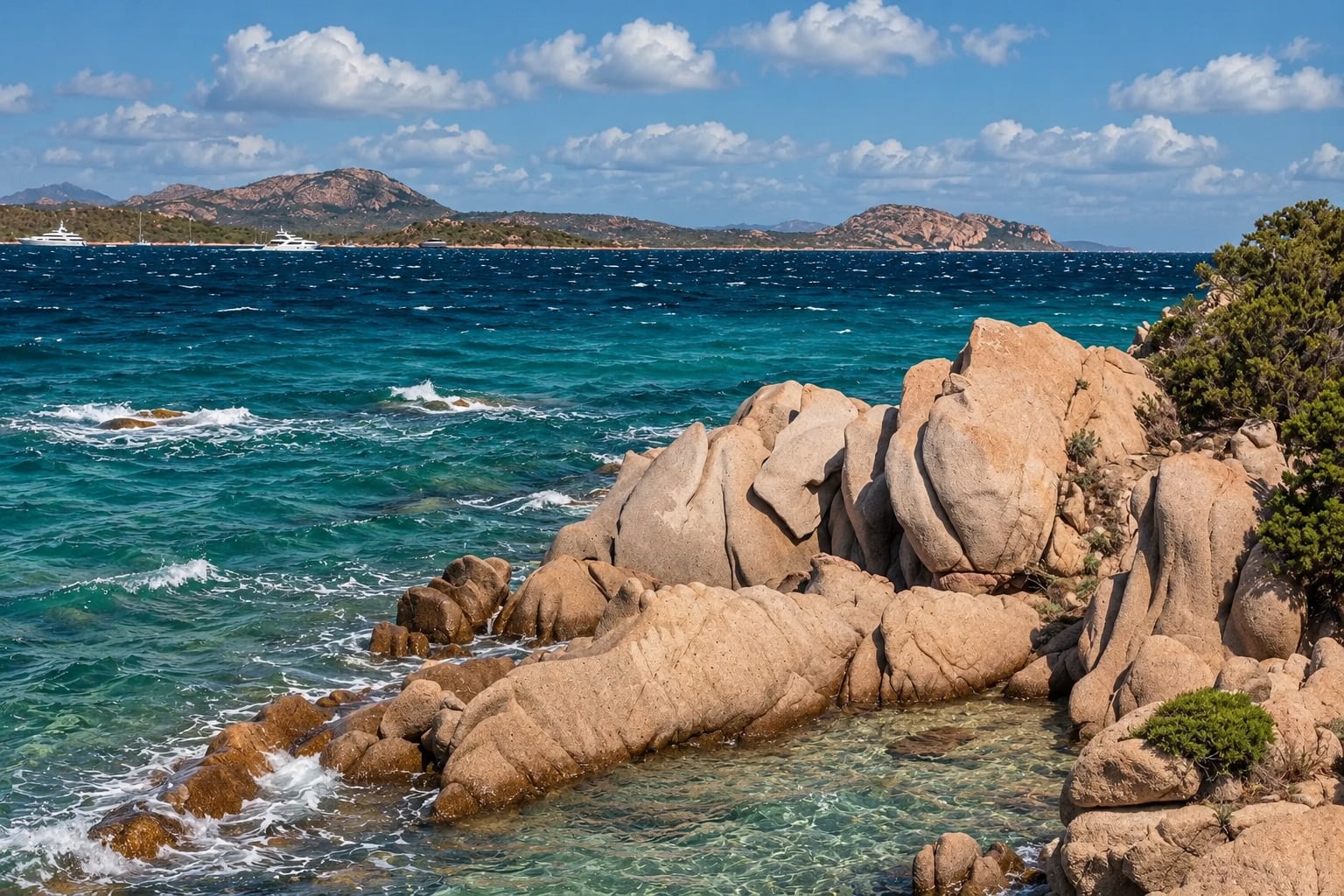
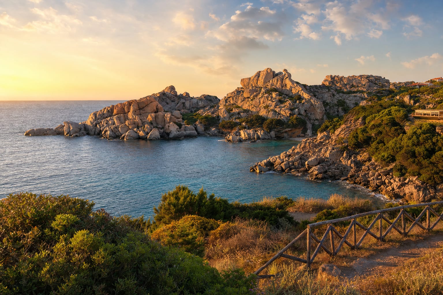 Santa Teresa GalluraCapo TestaWind-sculpted granite, Valle della Luna, Roman quarries, lighthouse, Corsica across the straitWind and sea have sculpted Capo Testa's granite into rounded boulders, slabs and hollows that look like an open-air gallery. The peninsula, joined to the mainland by a narrow isthmus with a beach on each side, lies about four kilometers from Santa Teresa Gallura and looks across the Strait of Bonifacio to Corsica; on a clear day you can pick out the Lavezzi Islands. The Romans quarried this stone from the first century BC, and the columns of the Pantheon were probably cut here; Pisan masons took columns for their cathedral in the twelfth century. The Valle della Luna, a maze of boulders running down to small coves, became a hippie haunt in the 1970s and remains the most beloved walk.
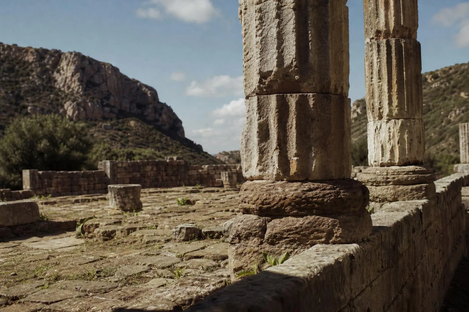 CarloforteHidden GemTemple of AntasPunic-Roman temple, Augustan rebuild, Nuragic village and necropolis, remote valley settingSix Ionic columns, each roughly eight meters tall, rise alone in a limestone valley south of Fluminimaggiore, the closest thing Sardinia has to a Greek ruin. The Carthaginians raised the first shrine here around 500 BC to Sardus Pater Babai, a god they called Sid Addir, choosing the site for a spring the Nuragic islanders had already revered for centuries. Rome rebuilt the temple under Augustus around 38 BC and restored it again two centuries later under Caracalla. Buried and forgotten, it was rediscovered in 1836 by General Alberto La Marmora, though the columns standing today were reconstructed only in 1967. A Nuragic village and necropolis, excavated in 1984, spread across the same valley floor, and the show cave of Su Mannau lies a short drive away.
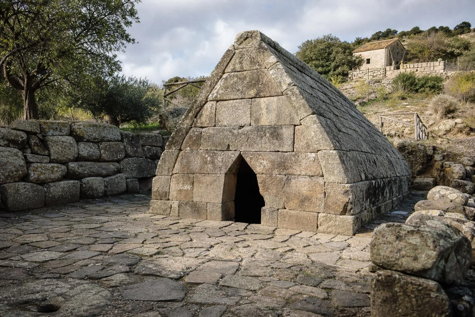 NuoroHidden GemSacred Spring of Su TempiesuBest-preserved Nuragic sacred spring, isodoma basalt masonry, 1953 rediscovery, bronze votive figurinesA landslide buried this Nuragic sacred spring sometime around the ninth century BC, and it lay forgotten until 1953, when workers doing water-vein maintenance broke into it by accident near Orune. What they found was the best-preserved sacred well of its kind on the island: a spring chamber built from precisely cut basalt blocks in true isodoma masonry, its double-pitched roof rising to about 1.8 meters, preceded by a vestibule and a smaller mirror-image spring beside it. Excavations in the 1950s and restoration campaigns in 1981-86 and 1998, led by archaeologist Maria Ausilia Fadda, recovered bronze swords, daggers, fibulae and votive figurines of bearded warriors and a shepherd, now displayed at Sassari's national archaeological museum. Fewer than five thousand people visit each year, keeping the site's silence intact.
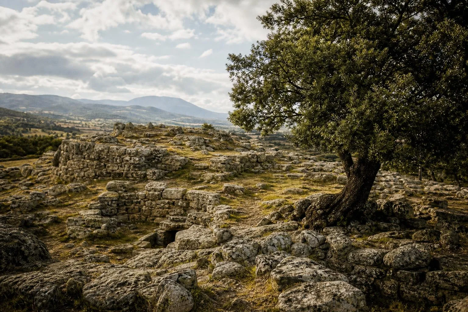 NuoroHidden GemSu RomanzesuSacred well and corridor, amphitheater gathering space, megaron temples, labyrinth structureArchaeologist Antonio Taramelli discovered this Nuragic sanctuary village above Bitti in 1919, though only about ten percent of its seventy-thousand-square-meter extent has been excavated since, most of it during seven campaigns led by Maria Ausilia Fadda between the late 1980s and 2001. Dating from the fourteenth to seventh centuries BC, the site centers on a sacred well linked by a long corridor to a stepped, amphitheater-like gathering space, alongside roughly a hundred hut foundations, two megaron-plan temples and a curious labyrinth structure whose purpose remains debated. A local cooperative now manages visits to the sanctuary, set at 750 meters in a cork-oak landscape reached by a mountain road from Bitti.
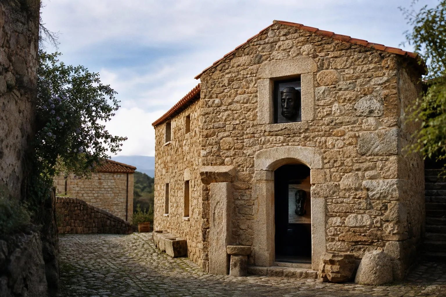 OrgosoloHidden GemMuseum of Mediterranean MasksMamuthones and Issohadores masks, Barbagia carnival tradition, Mediterranean masking comparisonsMamuthones and Issohadores, the two masked figures at the heart of Barbagia's carnival, are the subject of this small ethnographic museum in Mamoiada, which sets the local tradition inside a wider Mediterranean context of masking cultures. Historian Raffaello Marchi traced the contrast between the two figures, the somber, cowbell-hung Mamuthones and the sprightlier, red-costumed Issohadores who lasso onlookers with rope, to a legend of the Barbaricini defeating Moorish raiders long ago, though scholars continue to debate the masks' true origins. Two exhibition halls, the Sala del Carnevale barbaricino and the Sala del Mediterraneo, display costumes, masks and cowbells alongside comparative material from masking traditions elsewhere around the Mediterranean, drawing over seventeen thousand visitors in 2022 to a village otherwise known mainly for its role each January and Carnival season.
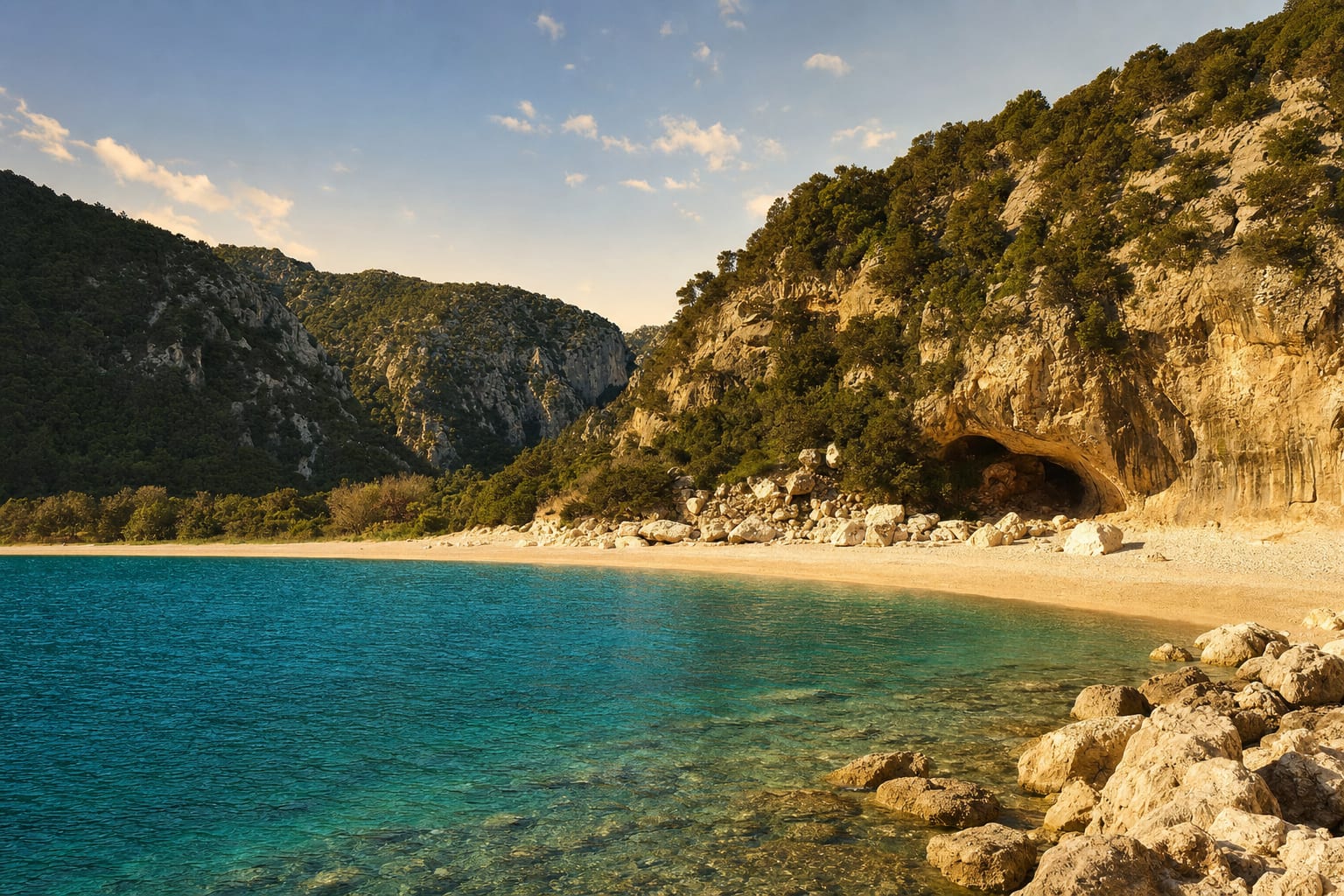 Cala GononeCala LunaCrescent beach between cliffs, shoreline caves, summer boats from Cala Gonone, Cala Fuili coastal trailA crescent of pale sand closes the mouth of an oleander-filled ravine on the Gulf of Orosei, backed by limestone cliffs riddled with caves that once sheltered shepherds and their flocks. There is no road in: boats from Cala Gonone run in summer, a short crossing, while hikers take the coastal trail from Cala Fuili, about 5 kilometers each way over rocky, shadeless ground. Many combine the two, walking down at dawn before the heat builds and catching the boat back, sharing the bay with day-trippers by midmorning.
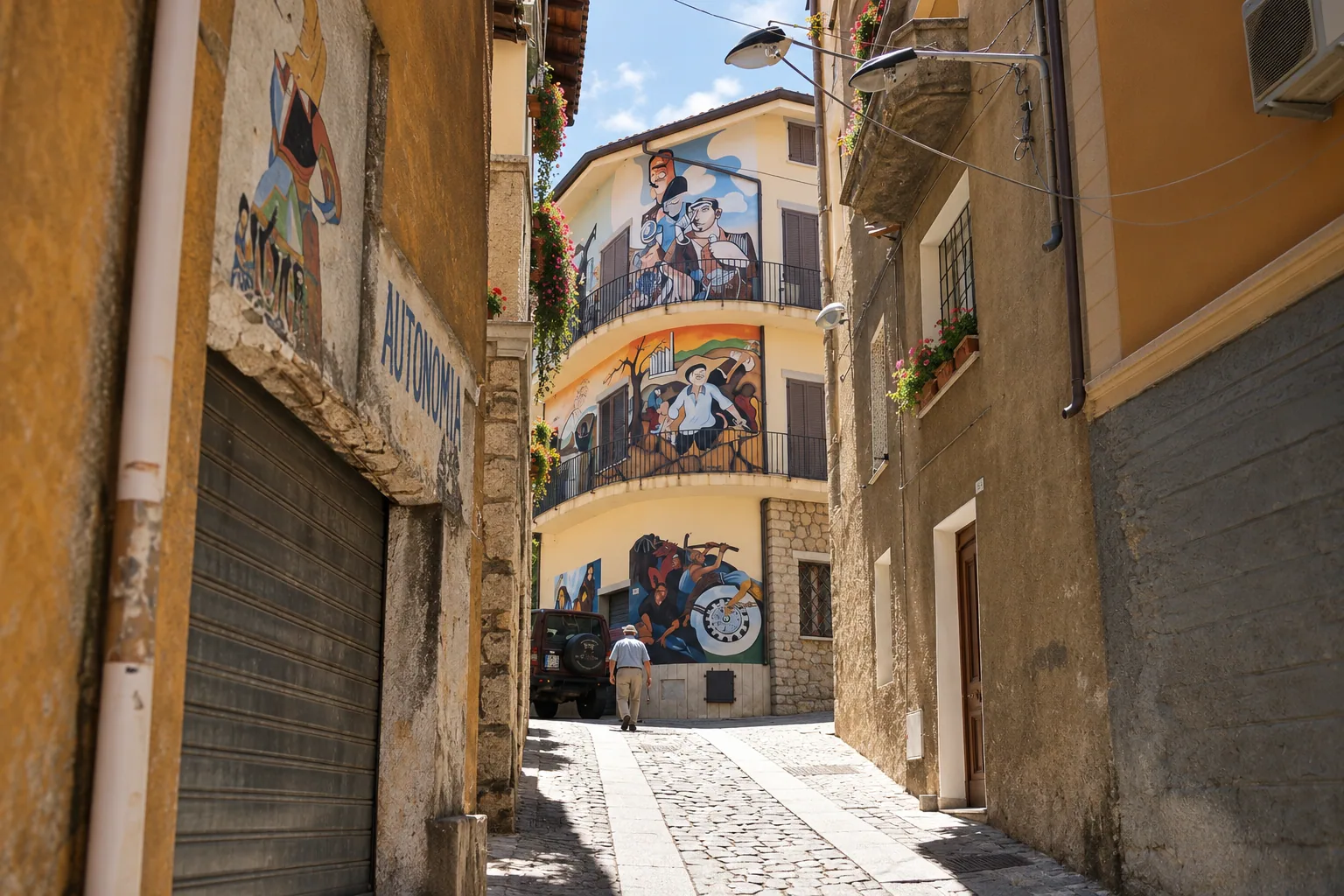 OrgosoloOrgosolo Murals700-plus political murals, Barbagia shepherd town, open-air protest gallery since 1969, Corso Repubblica walking routeOrgosolo's houses have carried political argument on their facades since 1969, when the anarchist collective Dioniso arrived to record the concerns of Sardinian shepherds and left the first murals behind. Francesco Del Casino, a mainland teacher, developed the practice further from 1975 with his students, and the town never stopped: more than seven hundred murals now cover Corso Repubblica and the lanes around it, addressing partisan history, anti-fascist resistance, war, women's rights and rural labor in bold, poster-like color. It reads less like street art curated for tourists and more like a shepherd town that decided to argue in public, in paint, for over fifty years running.
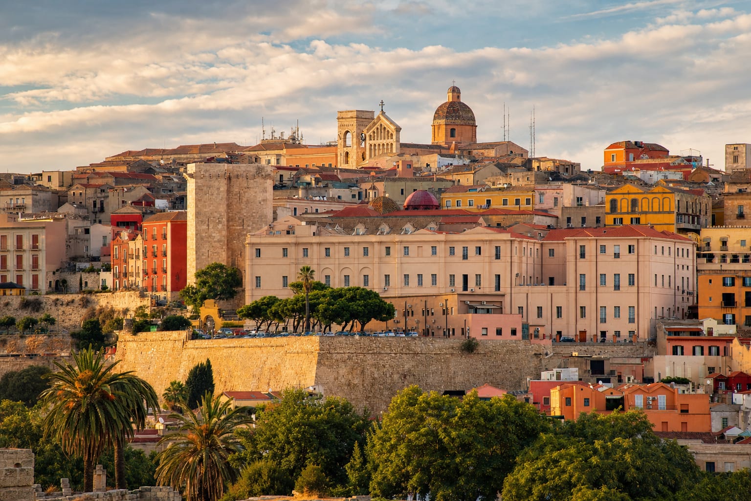 CagliariCastello DistrictWalled hilltop citadel, San Pancrazio and Elephant towers, Bastione di Saint Remy terrace, cathedral with martyrs' cryptCagliari's citadel quarter began as a Pisan fortress in the 13th century, when Pisa controlled trade across the western Mediterranean and transferred the seat of civil, military and religious power here from the old Judicate capital. Two towers, San Pancrazio and dell'Elefante, and long stretches of Spanish-reinforced walls still define its skyline, and inside them the Pisan-Romanesque cathedral, remade in Baroque between the 17th and 18th centuries, hides underground crypts holding the relics of Cagliari's martyrs. The Bastione di Saint Remy, built later as a monumental terrace, is now the quarter's grand public balcony, its wide steps and porticoed gallery looking straight out over the gulf and, on clear days, the pink shimmer of distant flamingo lagoons.
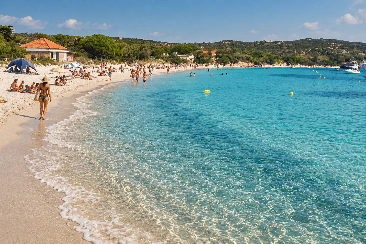 StintinoLa Pelosa BeachShallow turquoise lagoon, 16th-century Aragonese tower islet, views to Asinara, timed-entry reservationsLa Pelosa's sand shelves so gradually into the Golfo dell'Asinara that the turquoise water looks lit from below even on an overcast day, with the small 16th-century Aragonese watchtower on its offshore islet completing a view that regularly tops lists of Italy's best beaches. That fame is exactly the problem: unmanaged crowds and erosion pushed the comune of Stintino to cap daily access with timed, numbered reservations, a system considered a model for other overwhelmed Italian beaches. The uninhabited island of Asinara, a former penal colony turned national park, is visible just offshore, its wild horses and abandoned prison buildings a striking contrast to the beach's manicured turquoise.