

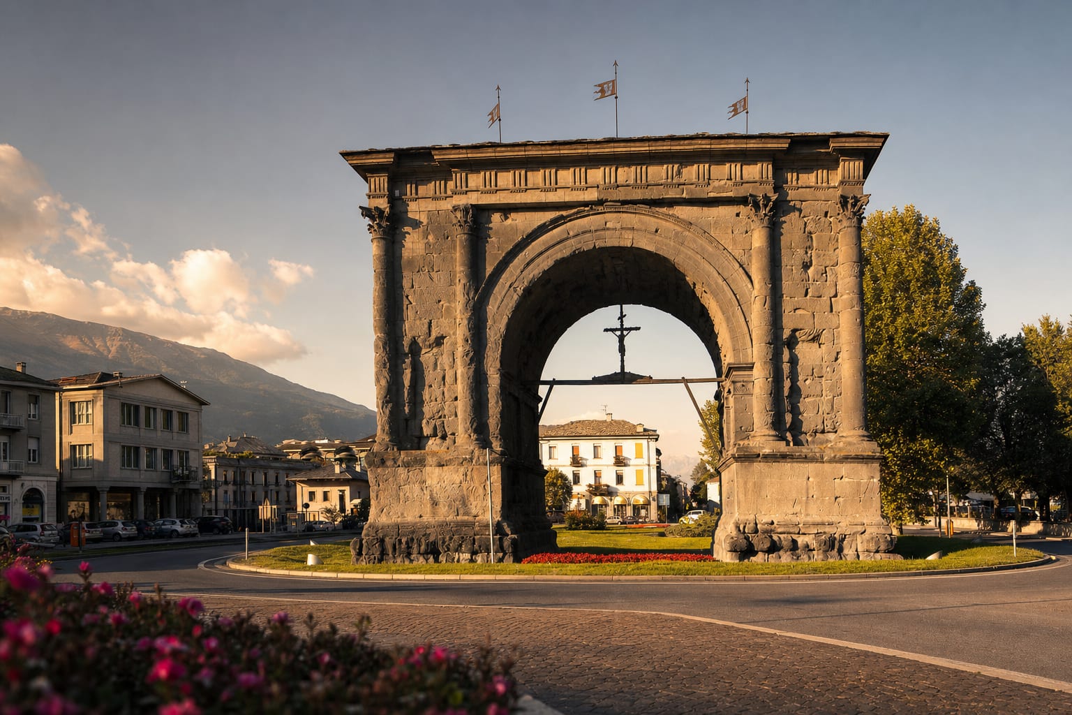
The regional capital, founded by Augustus as Augusta Praetoria in 25 BC and still laid out on its Roman grid.
The Arch of Augustus and the great wall of the Roman theatre rise among the streets, while the cathedral and the priory of Sant'Orso guard medieval frescoes and a carved Romanesque cloister.
When to visit Aosta
Average highs and lows across the year.
What to see first
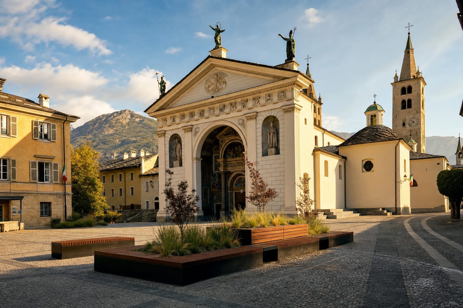
Aosta Cathedral
A plain neoclassical facade hiding eleventh-century frescoes and centuries of mosaic floors.
Read the guide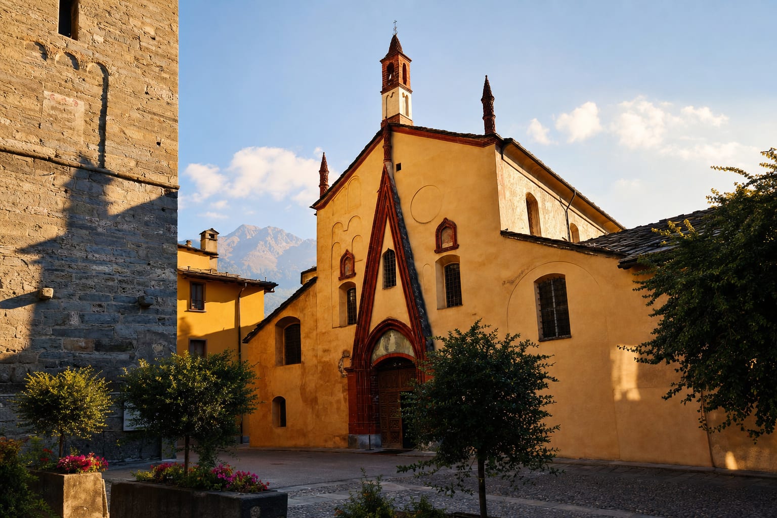
Eating and drinking in Aosta
Well-loved everyday tables and Michelin stars, each checked open.
- AuraPizzeria
- Pizzeria Farina Del Mio SaccoPizzeria
- PourmangerTrattoria
- Fuori dal piattoPizzeria
- Chez JulieTrattoria
- Les GourmetsPizzeria
Michelin-starred
- Paolo Griffa al Caffè Nazionale ★
- Vecchio Ristoro ★
Sleeping in Aosta
Well-reviewed places to stay, each checked open, by town.
- Le Rêve Charmant
- Vecchio Mulino Guest House
- Hotel Milleluci
- OMAMA Social Hotel
- Le Charaban
- Duca D'Aosta Modern Retrò Hotel
The year in Aosta
The rituals, races, and processions the city still keeps.
Aosta in a nutshell
Aosta is best understood as several cities occupying the same valley-floor rectangle. Augusta Praetoria was founded in 25 BC and laid out between the Buthier, the Dora Baltea, and the mountain slope. Its orthogonal street plan, gates, walls, forum, and entertainment quarter still organize a surprising amount of the historic centre. Later Christian communities placed funerary churches outside the Roman walls and reshaped the sacred area beside the forum. Medieval religious and civic institutions then created a second geography around the Cathedral, Sant'Orso, the Cité, and the Bourg de Saint-Ours. Piazza Chanoux became the modern civic hinge between those older districts.
This density makes Aosta walkable, but it also invites a misleading checklist. The Arch of Augustus is outside the Roman walls and is not Porta Praetoria. The Cryptoporticus supported and bounded the forum's raised sacred terrace; it was not simply a tunnel. The Roman Theatre and the remains of the Amphitheatre formed an entertainment quarter, but they are separate structures with different access. The Cathedral, its Treasury Museum, the Sant'Orso collegiate church, its cloister, priory, and the early Christian church of San Lorenzo are likewise distinct places. A good visit treats these as distinct places and uses the streets between them to understand the changing city.
The municipality has two legally official forms, Aosta and Aoste, and it belongs directly to the special autonomous region rather than to an ordinary province.
Before Rome: Saint-Martin-de-Corléans
The deepest chronology lies west of the Roman centre at Saint-Martin-de-Corléans. MegaMuseo is both a contemporary archaeological museum and the protected setting of an archaeological area. The official interpretation follows more than six millennia, from late Neolithic activity through Copper, Bronze, and Iron Age phases, Roman and late antique use, and the medieval landscape. The first documented intervention is a set of plough furrows cut near the end of the fifth millennium BC. The heritage authority interprets this as probably ritual activity, an interpretation rather than a known ceremony.
The site then developed through pits containing plant remains and burnt material, alignments of wooden posts, and more than forty anthropomorphic stone stelae. During the third millennium BC, megalithic funerary monuments changed the area's function. Tomb 2 contained the remains of thirty-nine people; the institution also records three skulls with evidence of trephination, two showing long-term healing. The human remains belong to a tomb context and deserve respectful treatment, not curiosity.
Allow a focused half day for this western district if prehistory is important. The museum is not beside the Roman circuit, and rushing it between central monuments weakens both experiences.
Reading Augusta Praetoria as a system
The Roman city was not a loose collection of photogenic ruins. Its rectangle followed natural boundaries, while the Decumanus Maximus carried the principal east-west movement and the Cardo Maximus crossed it farther west. Perpendicular streets divided the interior into blocks. The forum sat near the intersection of the main axes; the Theatre and Amphitheatre occupied three blocks in the north-east; houses and daily activity filled the rest. Outside the walls stood the honorific arch, the Buthier bridge, cemeteries, roads, and productive or residential sites such as the Consolata villa. Walking this plan gives each monument a role.
Start east of the walls at the Arch of Augustus. It marked the Roman victory over the Salassi and the foundation of the colony in 25 BC. Its single round-headed opening is roughly nine metres wide. The surviving architecture includes Corinthian half-columns and a Doric entablature, while the attic and its bronze-letter dedication have been lost. Continue toward Porta Praetoria, but do not merge the two. The arch stood on the approach; the gate controlled the eastern entrance through double facades, three passages, and an internal court. The central passages served vehicles and the lateral ones pedestrians.
The walls originally defined a rectangle about 727.5 metres on the long sides and 574 metres on the short ones. The regional heritage account describes concrete faced with travertine blocks, a base almost two metres thick, an original height of about 6.5 metres, and a system of gates and towers. Medieval adaptation is part of their history: towers became residences and fortifications, masonry was reused, and later streets grew through the Roman framework. A circuit should therefore include surviving stretches and transformed towers rather than promising an uninterrupted ancient wall walk.
Porta Praetoria leads onto the old Decumanus, now traced by central streets. Its relationship to the theatre explains why the entertainment district was convenient for people arriving from outside the city. Westward, the vanished Porta Decumana and surviving remains beneath the Regional Archaeological Museum help complete the plan. The Roman Bridge stands still farther east because the Buthier later changed course. Treating bridge, arch, gate, street axis, forum, and western exit as a sequence is more revealing than visiting them in arbitrary order.
Forum, sacred terrace, and Cryptoporticus
The Roman forum occupied more than three hectares and responded to sloping ground through two levels. Public and commercial activity took place around the lower square, while two temples stood on an elevated sacred terrace. The U-shaped Cryptoporticus framed and supported that upper zone on three sides. Its paired galleries, limestone columns, arches, and barrel vaults are architectural evidence for the forum's construction, not proof of a single agreed ritual purpose. The official interpretation connects the temples with deified Augustus and Roma, while presenting that identification as based on epigraphic evidence and study.
The Cryptoporticus is entered through a modern access point near the Cathedral, a reminder that today's visitor route is not the ancient one. Visitors who cannot use the underground route can still read the forum through the surface paving, the Cathedral area, and the wider city plan.
The proximity of forum and Cathedral is historically important. The fourth-century Christian complex stood beside the Roman sacred area, and the eleventh-century Cathedral was erected straddling the Cryptoporticus. This architectural relationship does not merge the two into one site or one ticketed experience. Quiet observation outside can be as valuable as moving quickly between interiors: the alignment of modern Piazza Giovanni XXIII, the church, and the hidden Roman terrace makes the change in urban authority legible.
Roman Theatre and the eastern archaeological quarter
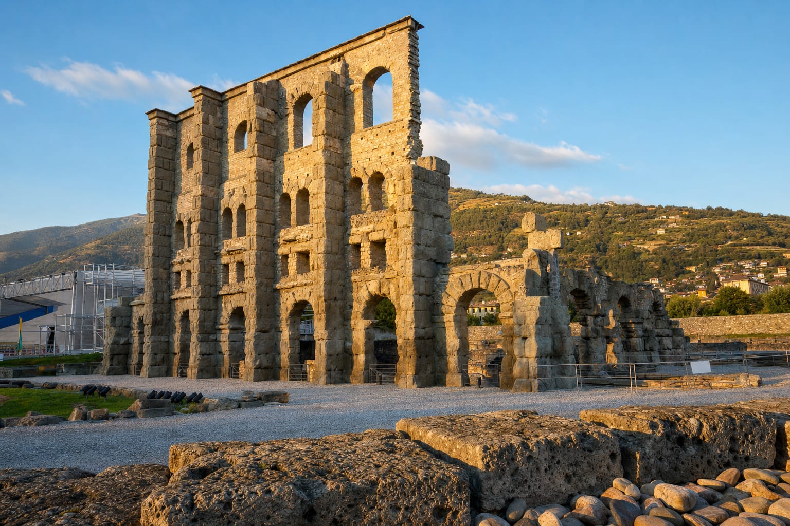
The Roman Theatre was begun in the Julio-Claudian period, around AD 20 to 30. Its cavea and stage were enclosed by a rectangular perimeter, and the surviving southern facade rises about twenty-two metres. The adjacent Amphitheatre followed later in the first century. Together they formed a specialized entertainment quarter near Porta Praetoria, but the Amphitheatre's surviving arcades are incorporated into a religious complex and do not share the Theatre's normal public route.
Give the Theatre enough time to read the building rather than only its facade. The museum authority's historical account also explains how twentieth-century excavation and restoration were shaped by their period, including the political promotion of Roman identity during the Fascist era. That context belongs in interpretation, especially when older photographs or reconstructed portions are shown. It helps distinguish the ancient remains from the history of their recovery and display.
MAR: collections, city plan, and objects
The MAR, Museo Archeologico Regionale, is an institution in Piazza Roncas, housed in a building above remains of Porta Principalis Sinistra. Its displays focus strongly on Augusta Praetoria while placing the city in a broader regional chronology. The official museum account traces the institution from a Royal Museum of Antiquity opened in 1929 in the Sant'Orso complex to the current museum, inaugurated in 2004 and subsequently renewed.
Use MAR to consolidate the plan seen outdoors. Models, architectural remains, inscriptions, funerary material, and objects from the Roman city can connect streets and monuments that survive unevenly. The Pautasso numismatic collection is one distinct grouping: a bequest donated to the Region in 1989, spanning Celtic, northern Italian pre-Roman, Greek, Italic, Roman, Byzantine, medieval, and Savoy coinage. It can support stories about exchange, imagery, and changing political systems, though only part of the bequest is normally on view.
From necropolis to Christian city
Outside the eastern walls, the Roman road and cemetery landscape became a focus of early Christianity. Beneath the church of San Lorenzo are the remains of a fifth-century funerary church used for burials of early members of the diocese and bishops. The regional heritage authority presents it as crucial evidence for the transition from the Roman city to a different Christian urban order. It is a separate archaeological site beneath a later church and should not be flattened into the neighboring Sant'Orso complex.
Sant'Orso itself contains several layers. Excavations documented an early Christian complex and subsequent rebuilding. The present church preserves an eleventh-century fresco cycle in the attic, an ancient crypt, a fifteenth-century wooden choir, and a floor mosaic with Samson and the lion. The Romanesque cloister, already in existence by 1133, is distinguished by carved capitals with biblical, hagiographic, animal, and decorative subjects. The priory chapel, cloister, fresco route, church, treasury material, and San Lorenzo archaeology are distinct places with their own visit conditions.
The church remains a place of worship. Respect liturgy, confirm photography rules, and decide in advance whether the visit is primarily architectural, archaeological, devotional, or collection-based.
Cathedral, treasury, and Ottonian Aosta
The Cathedral of Santa Maria Assunta developed from an early Christian complex beside the Roman forum. Its own institutional history documents a substantial single-nave church with service rooms and two baptisteries in the second half of the fourth century. In the eleventh century, probably under Bishop Anselm, a new Ottonian building was erected straddling the Roman Cryptoporticus. Later medieval and early modern campaigns changed the choir, ambulatory, cloister, chapels, facade, and furnishing. A single construction date cannot explain the building.
The frescoes in the attic belong to the eleventh-century phase and are related in date and context to the cycle at Sant'Orso. They form an immovable painted cycle within the Cathedral rather than a museum collection, and the Cathedral remains a living church where Masses and diocesan use take precedence over visits.
The Cathedral Treasury Museum occupies the ambulatory and combines objects from the Cathedral treasure with works from other parishes in the valley. Its holdings include the late Roman consular diptych of Honorius, a Roman cameo reused in a thirteenth-century gold setting as a cope clasp, the reliquary chest of Saint Gratus, Gothic sculpture, Limoges work, silver reliquary busts, and fifteenth-century marble funerary sculpture by Stefano Mossettaz.
Civic Aosta and the two historic districts
Piazza Chanoux is the modern orientation point, but its meaning depends on older boundaries. The Comune explains that the neoclassical Hôtel de Ville was completed in 1841 after the demolition of the fourteenth-century monastery of San Francesco. Its site lay between the Bourg de Saint-Ours and the Cité, which had formerly maintained separate mayors and councils. The two exterior fountains represent the Dora Baltea and Buthier; inside are civic memorials, a regional model, and the frescoed Salone Ducale.
The square also contains Hôtel des Etats, associated with the Conseil des Commis established in 1536, and a 1924 monument by Piero Canonica. These are separate civic monuments rather than decorative details of the town hall. Piazza Chanoux works best as a pause between the Roman east-west street and the northward route to Cathedral and forum. It can also introduce the linguistic reality of Aosta/Aoste, where Italian and French official forms coexist within the special-region structure.
For visitor flow, it helps to think in districts rather than vague neighborhoods. The Roman and medieval core runs from the Arch through Porta Praetoria, Sant'Orso, Theatre, Piazza Chanoux, Cathedral, and Cryptoporticus. The western extension reaches Piazza Roncas and the former Porta Principalis Sinistra before continuing toward Saint-Martin-de-Corléans. The station and bus terminal form a southern arrival zone near the wall circuit.
What Aosta's museums do, and do not, contain
Institutions and collections are different things. MAR interprets regional archaeology with a strong Augusta Praetoria focus and includes the Pautasso and other collections. MegaMuseo combines an in-situ archaeological area with a contemporary museum route. The Cathedral Treasury is an ecclesiastical collection in the Cathedral. Sant'Orso includes an active church, immovable frescoes, carved capitals, choir, priory, and treasury relationships. San Lorenzo is an archaeological site. The Roman Theatre is a monument and event setting, not a museum merely because it has panels and a ticket.
That distinction improves planning. Someone interested in prehistory should prioritize MegaMuseo; someone studying Roman urbanism needs the outdoor circuit, Cryptoporticus, Theatre, and MAR; someone focused on medieval art should divide time between Cathedral and Sant'Orso. Collections can rotate, works can travel, and religious spaces can close for worship.
Food and wine without false city ownership
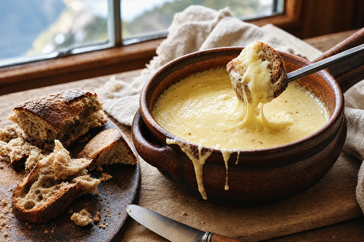
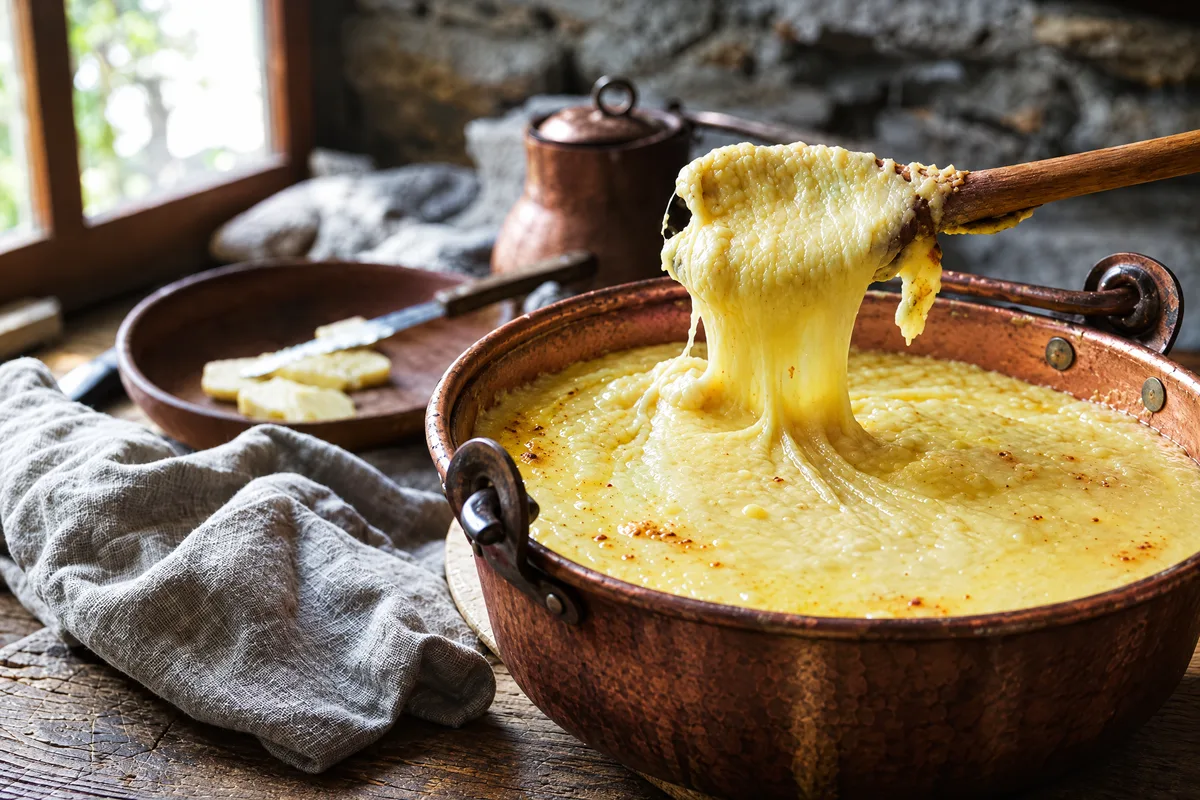
Aosta is a useful place to encounter the region's food traditions, but the capital cannot claim every Valdostan product as specifically Aostan. Protected designations tie a product to the production or processing geography fixed by its specification; serving or selling it in Aosta does not transfer that protected origin to the city.
The regional PAT inventory is another layer. It includes products such as boudin, mocetta and motzetta, several dairy products, breads, honey, ratafià, and Seupa à la vapelenentze. PAT recognition concerns documented traditional methods and is not the same legal category as DOP, IGP, or STG. A restaurant menu shows what that restaurant serves, not city origin or protected status.
The regional wine denomination is Valle d'Aosta or Vallée d'Aoste DOP. Aosta sits within the central valley wine landscape, but vineyard, producer, geographic mention, and city restaurant are distinct things. When tasting, ask for the exact protected name and producer, and keep it responsible. A regional denomination is not an exclusive city specialty.
Protected spirits require the same provenance discipline. Genepì della Valle d'Aosta / Génépi de la Vallée d'Aoste is registered as an Italian liqueur geographical indication, and Grappa della Valle d'Aosta / Grappa de la Vallée d'Aoste is registered under EU regulation as a protected spirit-drink geographical indication. These are regional protected geographies, not proof of production in Aosta city or availability at a particular bar, restaurant, shop, or producer.
Genepì della Valle d'Aosta and Grappa della Valle d'Aosta are each defined by their own technical file or register record, distinct from the generic Grappa specification and from Genepì del Piemonte. If you taste either spirit, keep it modest, eat, and walk, use public transport, or travel with a driver who is not drinking.
The lesson is provenance: identify protected names correctly, and distinguish regional availability from place of production. Seasonal menus and market stalls enrich a visit, but they change and are not permanent fixtures.
Fiera di Sant'Orso and the living centre
The Fiera di Sant'Orso is central to Aosta's craft identity. It is held in the historic centre at the end of January, with the Atelier des Métiers and a food pavilion extending around the main days.
During the fair, the ordinary calm walking logic of the historic centre changes completely, with crowds and street closures, so accommodation and transport are best planned around it.
Outside the fair, the craft tradition lives on in museums and workshops. The fair brings contemporary makers and institutions into the historic streets, and its value lies in living practice rather than an invented unbroken scene from the Middle Ages.
Arrival and movement
Drivers should not assume access to the historic core. Aosta's historic core is governed by municipal limited-traffic zones administered through a municipal permit system. The centre is compact enough to reward parking outside the restricted area and walking, though step-free routes, gradients, paving, snow, and construction can still vary by season.
Accessibility and practical care
There is no truthful city-wide label of accessible or inaccessible. Each monument, museum, and church sets its own physical-access conditions, and those conditions are best confirmed at the venue level.
Historic paving and winter conditions can change the path between otherwise accessible interiors, and a wheelchair symbol does not guarantee access to every chapel, crypt, attic, tower, or archaeological level.
Mountain weather can affect the valley floor and all regional excursions, especially side valleys and passes. In winter, allow for ice and shorter daylight; in summer, account for heat as well as storms.
Realistic itineraries
For one day, stay coherent. Begin at the Arch of Augustus, cross Porta Praetoria, and give the eastern quarter to Sant'Orso, San Lorenzo, and the Roman Theatre as access allows. Continue along the Roman Decumanus to Piazza Chanoux, then turn north for the Cathedral and Cryptoporticus. Choose either MAR or a longer sacred visit; attempting every interior reduces the city to ticket scans.
For two days, use the first for Roman urbanism and the second for longer collections. Pair the outdoor plan, Theatre, Cryptoporticus, and MAR on one day. On the other, take the western journey to MegaMuseo, then return for Cathedral and Sant'Orso with attention to frescoes, treasury, cloister, and early Christian archaeology. If an interior is closed, replace it with the wall and gate circuit rather than inventing access.
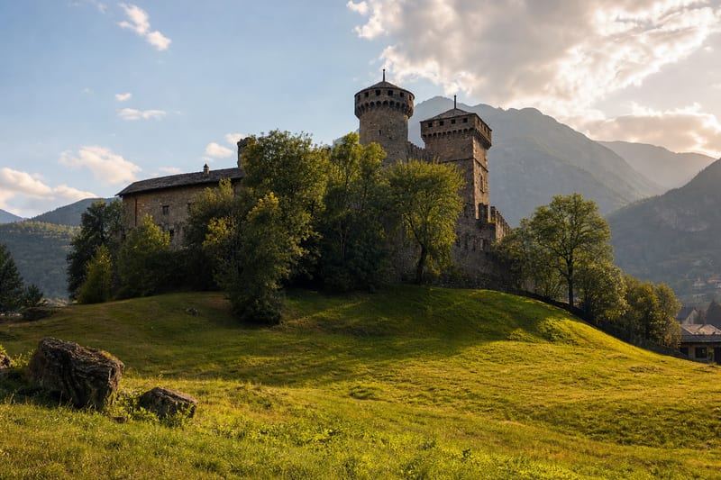
For three days, keep the third flexible. It can deepen craft and civic Aosta, add food and wine, or support a regional excursion. The castles near the capital belong to their own municipalities: Aymavilles, Sarre, Saint-Pierre, Fénis, and others. Aosta works well as a hub, but a hub relationship is not geographic ownership.
More of Aosta Valley
A letter from Italy, once a month.
The places, tables and makers we found worth your time. One email, no noise.
One letter a month. Unsubscribe at any time. We never share your address.